Protected area - grid: Difference between revisions
Jump to navigation
Jump to search
No edit summary |
No edit summary |
||
| Line 4: | Line 4: | ||
|Dimension=worldgrid | |Dimension=worldgrid | ||
|VariableType=driver | |VariableType=driver | ||
|DriverGroup=Environmental and other policies | |DriverGroup=Environmental and other policies | ||
|Source= | |Source=WDPA (http://www.wdpa.org): personal communication and special release on April 2011 | ||
|BasedOn=Own assumptions, derived from polygon maps | |BasedOn=Own assumptions, derived from polygon maps | ||
| | |Reference=WDPA (http://www.wdpa.org) | ||
|ExternalModel= | |ExternalModel= | ||
}} | }} | ||
The WDPA consists of polygon and point shapefiles. The polygon shape files describe the knkown delineated boundary for the protected areas, we only used the polygon data. The current published version of the WDPA is the 'WDPA Annual Release 2010', this set is based on a more recent (corrected) version. | |||
Revision as of 09:38, 10 March 2014
| Label: | Protected areas |
| Description: | Map of protected nature areas, limiting human activities |
| Dimensions: | worldgrid |
| Variable type: | driver |
| Driver group: | Environmental and other policies |
| Source: | WDPA (http://www.wdpa.org): personal communication and special release on April 2011 |
| Values based on: | Own assumptions, derived from polygon maps |
| Reference: | WDPA (http://www.wdpa.org) |
Drivers are described in the Drivers component.
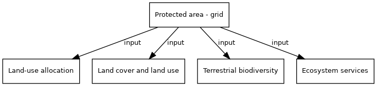
Variable is input of model component(s):
- Click on a box to open the model component.
The WDPA consists of polygon and point shapefiles. The polygon shape files describe the knkown delineated boundary for the protected areas, we only used the polygon data. The current published version of the WDPA is the 'WDPA Annual Release 2010', this set is based on a more recent (corrected) version.