Flowchart Land degradation
Jump to navigation
Jump to search
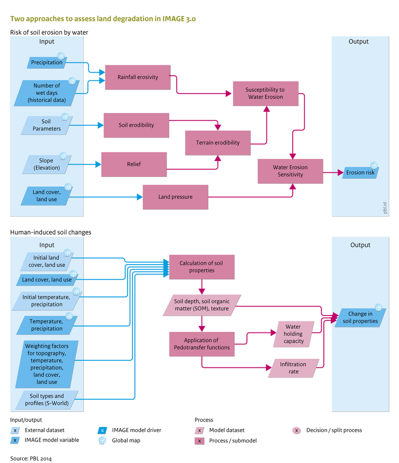
Caption: More detail on inputs and outputs, and how they link to other IMAGE components is presented at Input/Output Table.
Figure is used on page(s): Land degradation
Caption: More detail on inputs and outputs, and how they link to other IMAGE components is presented at Input/Output Table.
Figure is used on page(s): Land degradation