High resolution land cover (GLC2000) - grid: Difference between revisions
Jump to navigation
Jump to search
No edit summary |
No edit summary |
||
| Line 1: | Line 1: | ||
{{VariableTemplate | {{VariableTemplate | ||
|Label=Land cover data from GLC2000 | |Label=Land cover data from GLC2000 | ||
|Description=The GL2000 map is produced by an international partnership of 30 research groups coordinated by the European Commission's Joint Research Centre (JRC). The database contains two levels of land cover information—detailed, regionally optimized land cover legends for each continent and a less thematically detailed global legend that harmonizes regional legends into one consistent product. The land cover maps are all based on daily data from the VEGETATION sensor on-board SPOT 4. Within the GLOBIO model the less detailed global version is used. See 'E. Bartholomé and A. S. Belward, "GLC2000: A new approach to global land cover mapping from earth observation data," Int. J. Remote Sens., vol. 26, pp. 1959-1977, 2005.' | |Description=The GL2000 map is produced by an international partnership of 30 research groups coordinated by the European Commission's Joint Research Centre (JRC). The database contains two levels of land cover information—detailed, regionally optimized land cover legends for each continent and a less thematically detailed global legend that harmonizes regional legends into one consistent product. The land cover maps are all based on daily data from the VEGETATION sensor on-board SPOT 4. Within the GLOBIO model the less detailed global version is used. See 'E. Bartholomé and A. S. Belward, "GLC2000: A new approach to global land cover mapping from earth observation data," Int. J. Remote Sens., vol. 26, pp. 1959-1977, 2005.' | ||
|Dimension=time, worldgrid, landcovertype | |Dimension=time, worldgrid, landcovertype | ||
|VariableType=external parameter | |VariableType=external parameter | ||
Revision as of 12:35, 18 March 2014
| Label: | Land cover data from GLC2000 |
| Description: | The GL2000 map is produced by an international partnership of 30 research groups coordinated by the European Commission's Joint Research Centre (JRC). The database contains two levels of land cover information—detailed, regionally optimized land cover legends for each continent and a less thematically detailed global legend that harmonizes regional legends into one consistent product. The land cover maps are all based on daily data from the VEGETATION sensor on-board SPOT 4. Within the GLOBIO model the less detailed global version is used. See 'E. Bartholomé and A. S. Belward, "GLC2000: A new approach to global land cover mapping from earth observation data," Int. J. Remote Sens., vol. 26, pp. 1959-1977, 2005.' |
| Dimensions: | time, worldgrid, landcovertype |
| Variable type: | external parameter |
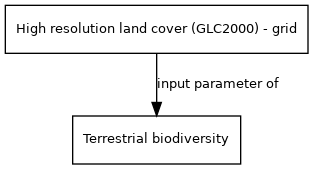
External parameter is input of model component(s):
- Click on a box to open the model component.