Topography - grid: Difference between revisions
Jump to navigation
Jump to search
No edit summary |
No edit summary |
||
| Line 1: | Line 1: | ||
{{VariableTemplate | {{VariableTemplate | ||
|Label=Topography | |Label=Topography | ||
|Description= | |Description=This indicator determines the maximum altitude in the surrounding 200 km, and determines the altitude range within the grid cell | ||
|Dimension=worldgrid | |Dimension=worldgrid | ||
|VariableType=external parameter | |VariableType=external parameter | ||
|Source2=globe task team | |||
|Reference2=GLOBE task Team 1999 the global land one-kilometer base evaluation (GLOBE) digital elevation model | |||
|DriverGroup= | |DriverGroup= | ||
|Source= | |Source= | ||
| Line 9: | Line 11: | ||
|Reference= | |Reference= | ||
|Source3= | |Source3= | ||
|Reference2=GLOBE task Team 1999 the global land one-kilometer base evaluation (GLOBE) digital elevation model | |||
|ExternalModelDriver= | |ExternalModelDriver= | ||
|ExternalModel= | |ExternalModel= | ||
}} | }} | ||
Revision as of 15:34, 3 April 2014
| Label: | Topography |
| Description: | This indicator determines the maximum altitude in the surrounding 200 km, and determines the altitude range within the grid cell |
| Dimensions: | worldgrid |
| Variable type: | external parameter |
| Source: | globe task team |
| Reference: | GLOBE task Team 1999 the global land one-kilometer base evaluation (GLOBE) digital elevation model |
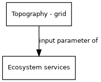
External parameter is input of model component(s):
- Click on a box to open the model component.