Topography, elevation - grid: Difference between revisions
Jump to navigation
Jump to search
m (RinekeOostenrijk moved page Topography to Topography - grid without leaving a redirect: Text replace - "Topography" to "Topography - grid") |
ArnoBouwman (talk | contribs) No edit summary |
||
| Line 1: | Line 1: | ||
{{VariableTemplate | {{VariableTemplate | ||
|Label=Topography | |Label=Topography | ||
|Description=Global topography and | |Description=Global topography and elevation. Digital elevation model | ||
|VariableType=parameter | |VariableType=parameter | ||
|Source2=HydroSHEDS (Hydrological data and maps based on SHuttle Elevation Derivatives at multiple Scales) | |||
|DriverGroup= | |DriverGroup= | ||
|Source= | |Source= | ||
|BasedOn= | |||
|Reference= | |||
|Source3= | |||
|ExternalModelDriver= | |ExternalModelDriver= | ||
|ExternalModel= | |ExternalModel= | ||
}} | }} | ||
Revision as of 17:10, 3 March 2014
| Label: | Topography |
| Description: | Global topography and elevation. Digital elevation model |
| Variable type: | parameter |
| Source: | HydroSHEDS (Hydrological data and maps based on SHuttle Elevation Derivatives at multiple Scales) |
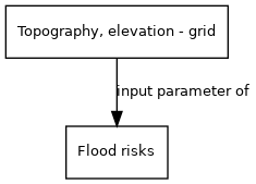
External parameter is input of model component(s):
- Click on a box to open the model component.
"parameter" is not in the list (model (from/to model), model (end-indicator), driver, external parameter, historical data) of allowed values for the "HasVariableType" property.