Topography - grid: Difference between revisions
Jump to navigation
Jump to search
No edit summary |
m (Text replace - "ExternalModel=" to "Model-Database=") |
||
| (3 intermediate revisions by 2 users not shown) | |||
| Line 1: | Line 1: | ||
{{VariableTemplate | {{VariableTemplate | ||
|Label=Topography | |Label=Topography | ||
|Description= | |Description=Topography and altitude, determining the altitude range within a grid cell. | ||
|Dimension=worldgrid | |Dimension=worldgrid | ||
|VariableType=external parameter | |VariableType=external parameter | ||
|Source2 | |Source2=GLOBE Digital Elevation Model | ||
|DriverGroup= | |DriverGroup= | ||
|Source= | |Source= | ||
| Line 11: | Line 10: | ||
|Reference= | |Reference= | ||
|Source3= | |Source3= | ||
|ExternalModelDriver= | |ExternalModelDriver= | ||
| | |Model-Database= | ||
}} | }} | ||
Latest revision as of 09:54, 24 May 2014
| Label: | Topography |
| Description: | Topography and altitude, determining the altitude range within a grid cell. |
| Dimensions: | worldgrid |
| Variable type: | external parameter |
| Source: | GLOBE Digital Elevation Model |
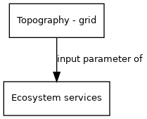
External parameter is input of model component(s):
- Click on a box to open the model component.