Baseline figure Flood risks: Difference between revisions
Jump to navigation
Jump to search
No edit summary |
No edit summary |
||
| Line 4: | Line 4: | ||
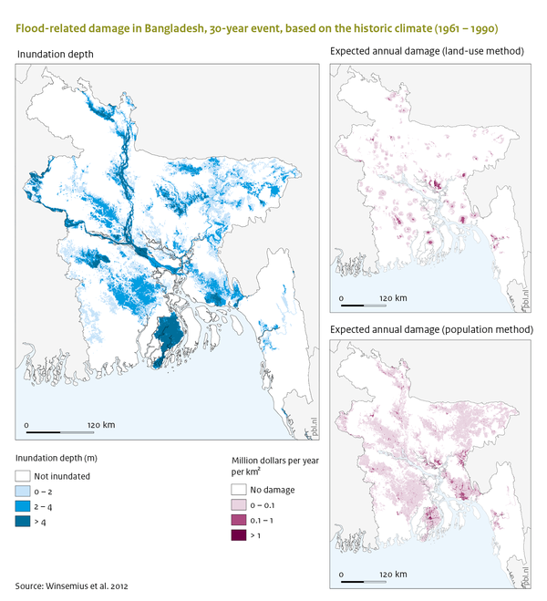
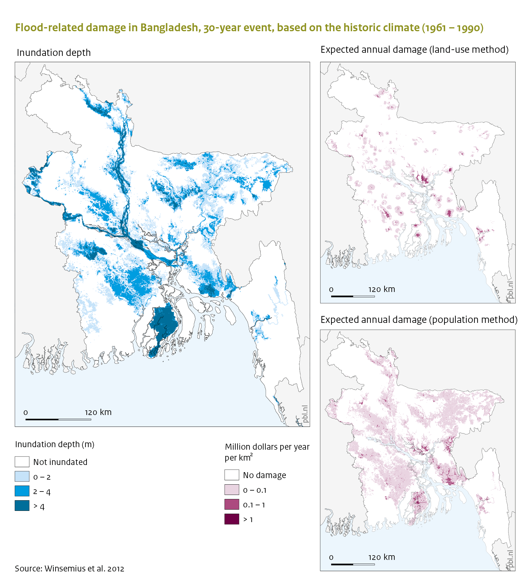
|Caption=From left to right: the 30-year flood, downscaled to Bangladesh; the expected value of annual damage (land-use method); and the expected value of annual affected GDP (population method), based on the reference climate (1961-1990) and the current population, land use, and GDP | |Caption=From left to right: the 30-year flood, downscaled to Bangladesh; the expected value of annual damage (land-use method); and the expected value of annual affected GDP (population method), based on the reference climate (1961-1990) and the current population, land use, and GDP | ||
|FigureType=Baseline figure | |FigureType=Baseline figure | ||
|OptimalSize= | |OptimalSize=600 | ||
|Component=Flood risks; | |Component=Flood risks; | ||
}} | }} | ||
Revision as of 11:30, 18 May 2014
Caption: From left to right: the 30-year flood, downscaled to Bangladesh; the expected value of annual damage (land-use method); and the expected value of annual affected GDP (population method), based on the reference climate (1961-1990) and the current population, land use, and GDP
Figure is used on page(s): Flood risks