Baseline figure Flood risks: Difference between revisions
Jump to navigation
Jump to search
No edit summary |
(CSV import) |
||
| Line 1: | Line 1: | ||
{{FigureTemplate | {{FigureTemplate | ||
|Figure=107x img13.png | |Figure=107x img13.png | ||
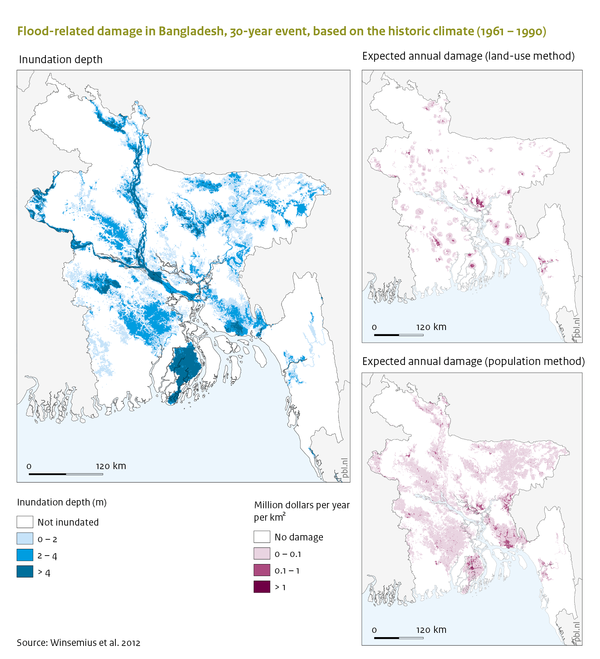
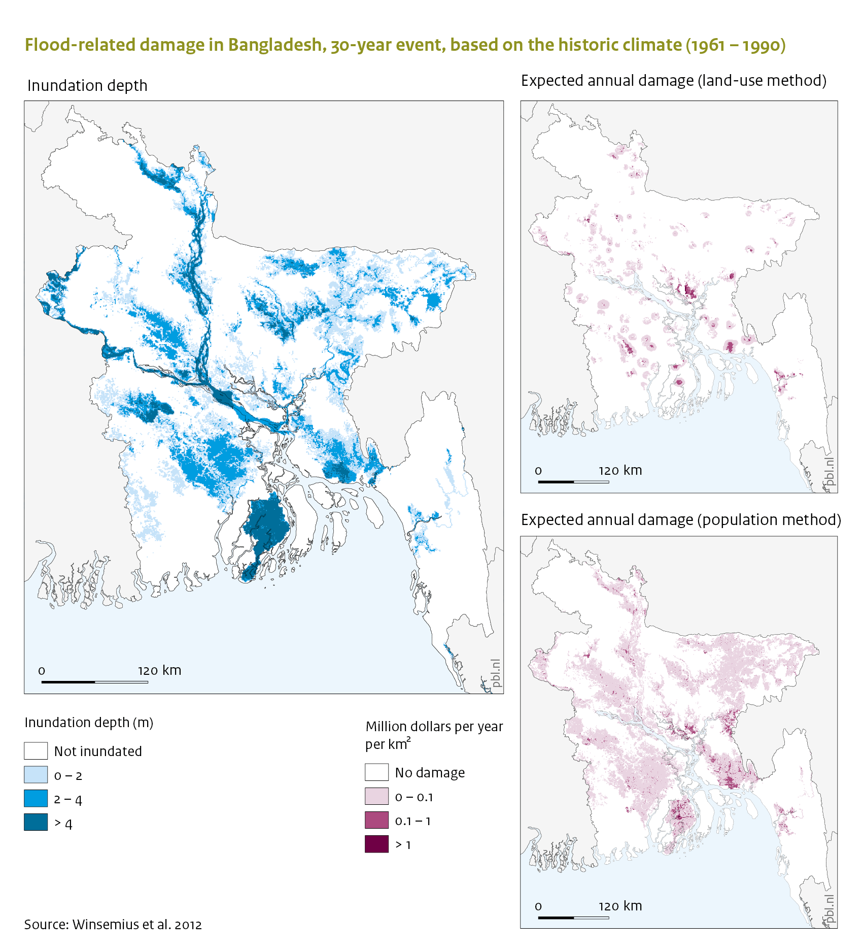
|AltText=Flood related damage in Bangladesh, 30 year event, based on the | |AltText=Flood-related damage in Bangladesh, 30-year event, based on the historic climate (1961-1990) | ||
|Caption= | |Caption=Inundation depth of 30-year flood scaled down to Bangladesh (left); The estimated annual damage due to floods (not only due to a 30-year event) is more concentrated when applying the land-use method compared to the population method. | ||
|FigureType=Baseline figure | |FigureType=Baseline figure | ||
|OptimalSize=600 | |OptimalSize=600 | ||
|Component=Flood risks; | |Component=Flood risks; | ||
}} | }} | ||
Revision as of 13:43, 23 May 2014
Caption: Inundation depth of 30-year flood scaled down to Bangladesh (left); The estimated annual damage due to floods (not only due to a 30-year event) is more concentrated when applying the land-use method compared to the population method.
Figure is used on page(s): Flood risks