Flowchart Land degradation
Jump to navigation
Jump to search
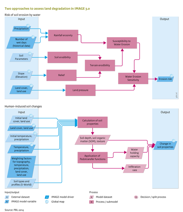
Caption: Flowchart Land degradation. See also the Input/Output Table on the introduction page.
Figure is used on page(s): Land degradation
Caption: Flowchart Land degradation. See also the Input/Output Table on the introduction page.
Figure is used on page(s): Land degradation