Region classification map: Difference between revisions
Jump to navigation
Jump to search
No edit summary |
No edit summary |
||
| Line 4: | Line 4: | ||
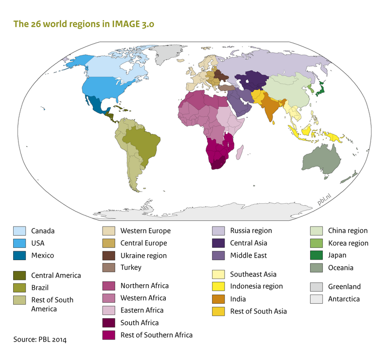
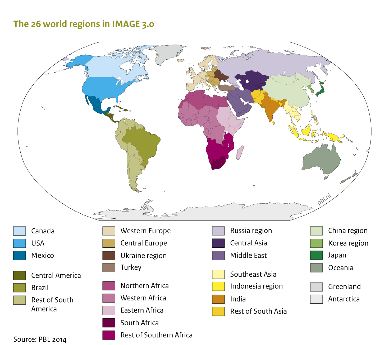
|Caption=The IMAGE framework region classification: The IMAGE land use regions | |Caption=The IMAGE framework region classification: The IMAGE land use regions | ||
|FigureType=Other type of figure | |FigureType=Other type of figure | ||
|OptimalSize= | |OptimalSize=800 | ||
|Component=Region classification | |Component=Region classification | ||
}} | }} | ||
Revision as of 11:58, 18 December 2013
Caption: The IMAGE framework region classification: The IMAGE land use regions
Figure is used on page(s): IMAGE framework summary/Description, IMAGE framework/IMAGE 3.0 in a nutshell