FAO deforestation rates: Difference between revisions
Jump to navigation
Jump to search
No edit summary |
No edit summary |
||
| Line 1: | Line 1: | ||
{{VariableTemplate | {{VariableTemplate | ||
|Label=FAO deforestation rates - grid | |Label=FAO deforestation rates - grid | ||
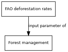
|Description=Historical deforestation rates in the IMAGE 3.0 regions, according to FAO | |Description=Historical deforestation rates in the IMAGE 3.0 regions, according to FAO. | ||
|Dimension=time, region | |Dimension=time, region | ||
|VariableType=external parameter | |VariableType=external parameter | ||
|Source2=FAO; | |Source2=FAO; | ||
|DriverGroup= | |DriverGroup= | ||
|Source= | |Source= | ||
Revision as of 15:13, 31 March 2014
| Label: | FAO deforestation rates - grid |
| Description: | Historical deforestation rates in the IMAGE 3.0 regions, according to FAO. |
| Dimensions: | time, region |
| Variable type: | external parameter |
| Source: | FAO; |
External parameter is input of model component(s):
- Click on a box to open the model component.